The Problem
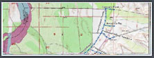
In 2005, FEMA wanted to determine flood hazards for the future development of La Paz County, Arizona. FEMA needed a contractor that could implement the study using the latest digital technology so they could transfer the results directly into FEMA’s Revised DFIRM mapping program, Geo-Firm. The study area included 30 stream miles.
The Solution
Massoud Rezakhani Consulting (MRC), LLC, in partnership with Dewberry, managed the first fully digital flood study and DFIRM submission from a cooperating technical partner (CTP) in Arizona. The Lapaz County Flood Insurance Restudy encompassed hydrology and hydraulics analyses and DFIRM production. The study was completed within the original timeframe of 12 months and on budget. As a result, FEMA is scheduled to publish the La Paz County, Arizona DFIRM in August 2008.
Project Highlights
- Flood insurance restudy included 30 stream miles
- First fully digital flood study and DFIRM submission in Arizona
- November 2006, MRC, LLC and Dewberry ask FEMA to revise status based on new findings
- Project completed on time and on budget
- August 2008, proejected FEMA DFIRM revision