The Problem
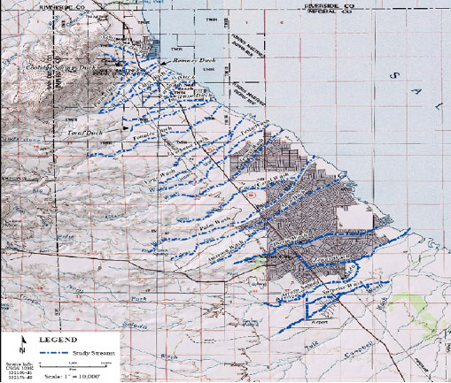
In 2003, FEMA wanted to determine flood hazards for the future development of the Coachella Valley in Imperial County, California, situated along the Salton Sea. Flood hazards along the sea had never been determined. The area included 25 streams, including Arroyo Salada, 82.5 linear miles of floodplain, and 120 miles of drainage area located within the unincorporated area of Imperial County.
The unique geography of the region presented an unusual and difficult-to-predict flood hazard due to alluvial fan and sheet shallow flooding. Alluvial fans are fan-shaped deposits of sediment caused by the path flood water takes coming out of a steep, narrow canyon. This type of flood hazard is difficult to predict, as the water can take a variety of paths as it fans out. Downstream from the alluvial fan flood risk is generally reduced, but can rise again as the water pools in culverts.
The Solution
Massoud Rezakhani Consulting (MRC), LLC in partnership with URS, Dewberry, Schaaf & Wheeler, Airborne1, and TerraPoint, worked closely with the Coachella Valley Water District and Imperial County to perform a Flood Insurance Study. Massoud Rezakhani is a technical consultant and a member of the Alluvial Fan Task Force, California.
The project included project scoping and management, topographic data collection, hydrology and hydraulics analysis, floodplain mapping, Digital Flood Insurance Rate Map (DFIRM) production and processing, CTP support, and disaster recovery mapping for riverine, coastal, and alluvial fan flood hazards within a deadline of eight months. Specialized flood risks identified included:
- intertwining and undefined channels
- split flows
- diversion dike
- surprise wash
- alluvial fans – Tonalee Fan and the Calyx Fan
The project team pioneered an innovative technique to determine the flood risks downstream of an alluvial fan. This technique was applied by FEMA for the first time ever in California. Only one or two people in the nation have used this technique.
As a result of this project, FEMA is scheduled to publish the Flood Insurance Rate Map for Imperial Counties and Incorporated Areas in August 2008. Development of the area has been approved in areas where the developers can mitigate the flood risks prior to development.
Project Highlights
- Project scope included 25 streams, 82.5 linear miles of floodplain, and 120 miles of drainage area
- Specialized flood risks included alluvial fans, intertwining and undefined channels, diversion dike, and surprise wash
- Project team pioneered an innovative technique for identifying flood risks downstream of an alluvial fan for FEMA
- Massoud Rezakhani is a technical consultant and a member of the Alluvial Fan Task Force, California
- Multi-agency project completed within the 8-month deadline and on budget