The Problem
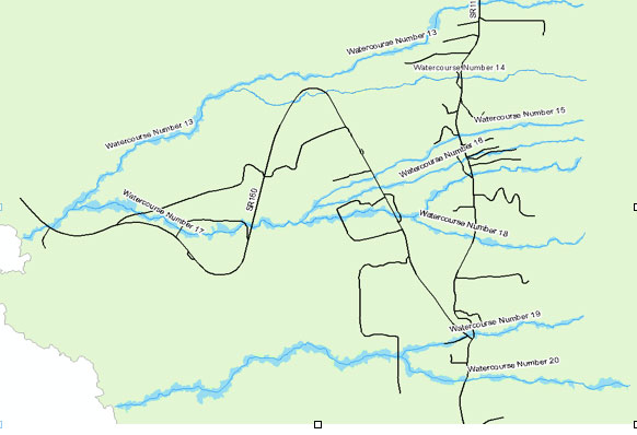
In 2007, the government requested a flood hazard study for the South Kona district on the island of Hawaii. The South Kona district was undergoing an increase in residential development in areas without adequate flood hazard maps, increasing the potential for flood damage and high flood insurance premiums.
While the Kona side of the island experiences limited rainfall due to the topography and elevation of the island’s volcanoes, during intense southerly storms significant flooding has occurred along the Kona, or western side of the island.
Solution
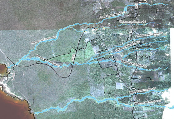
Massoud Rezakhani Consulting (MRC), LLC, as a sub-consultant to Group 70 International, managed the hydrologic and hydraulic flood plain studies for 10-, 25-, 50-, 100-, and 500- year flood plains of the South Kona District. The scope of work included obtaining LiIDAR survey data and determining the associated flood hazards for seven floodplain study areas. Services provided included:
- Site analysis
- Watershed topography
- Hydrologic analysis
- Hydraulic analysis
- GIS floodplain mapping
As a result of this study, the County of Hawaii was able to amend the Federal Emergency Management Agency’s (FEMA) Flood Insurance Rate Maps to more adequately define the flood hazard for these areas.
Project Highlights
- In 2007, the US Government requests a flood hazard study for the South Kona district of the island of Hawaii.
- MRC, LLC manages the hydrologic and hydraulic flood plain studies for 10-,
25-, 50-, and 100-year floodplains for 7 floodplain areas. - MRC’s findings force a FEMA flood insurance rate adjustment for Hawaii County.